


MBARI Collaborates with 3D at Depth
Partnership News / 20/06/2023
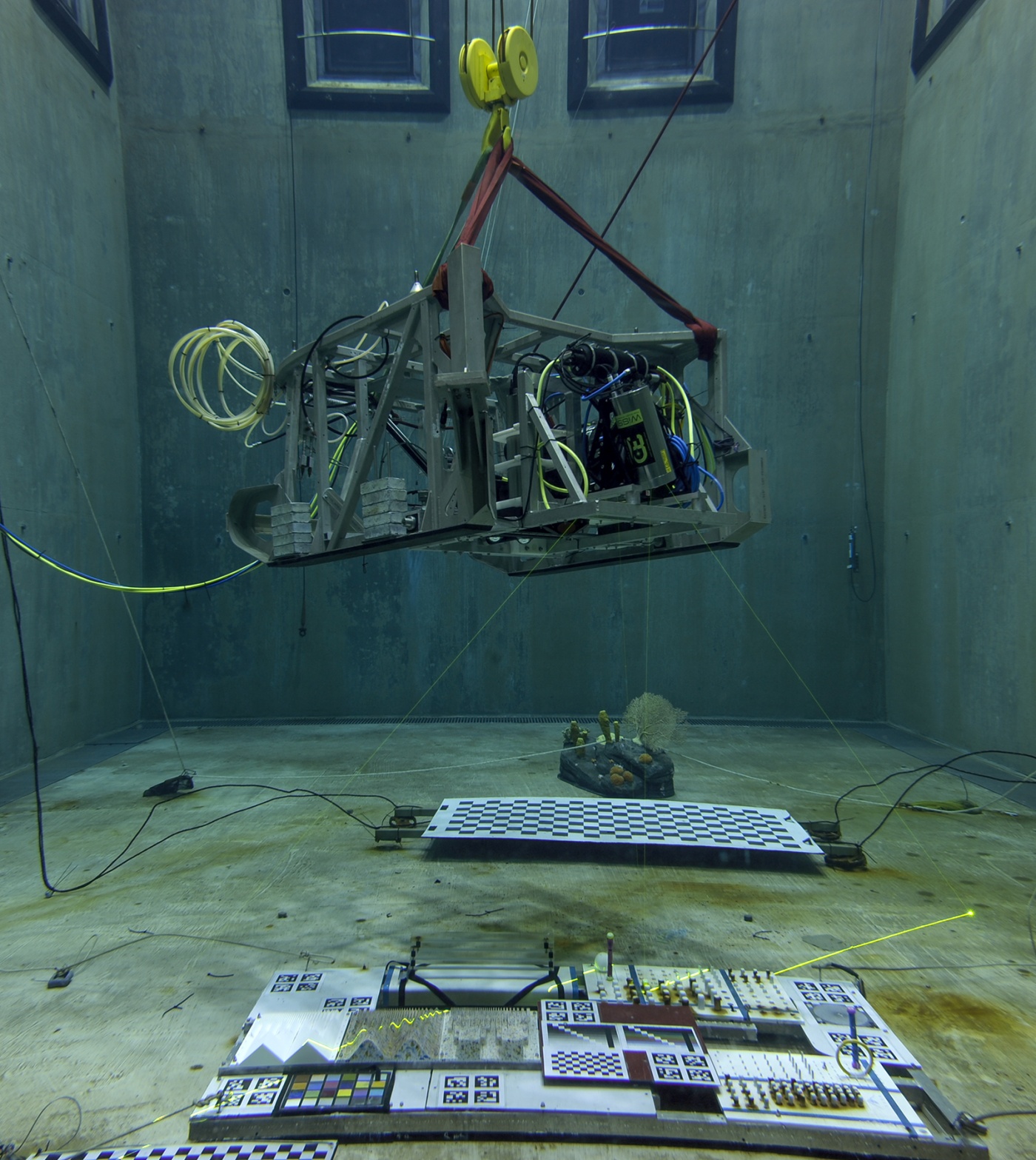
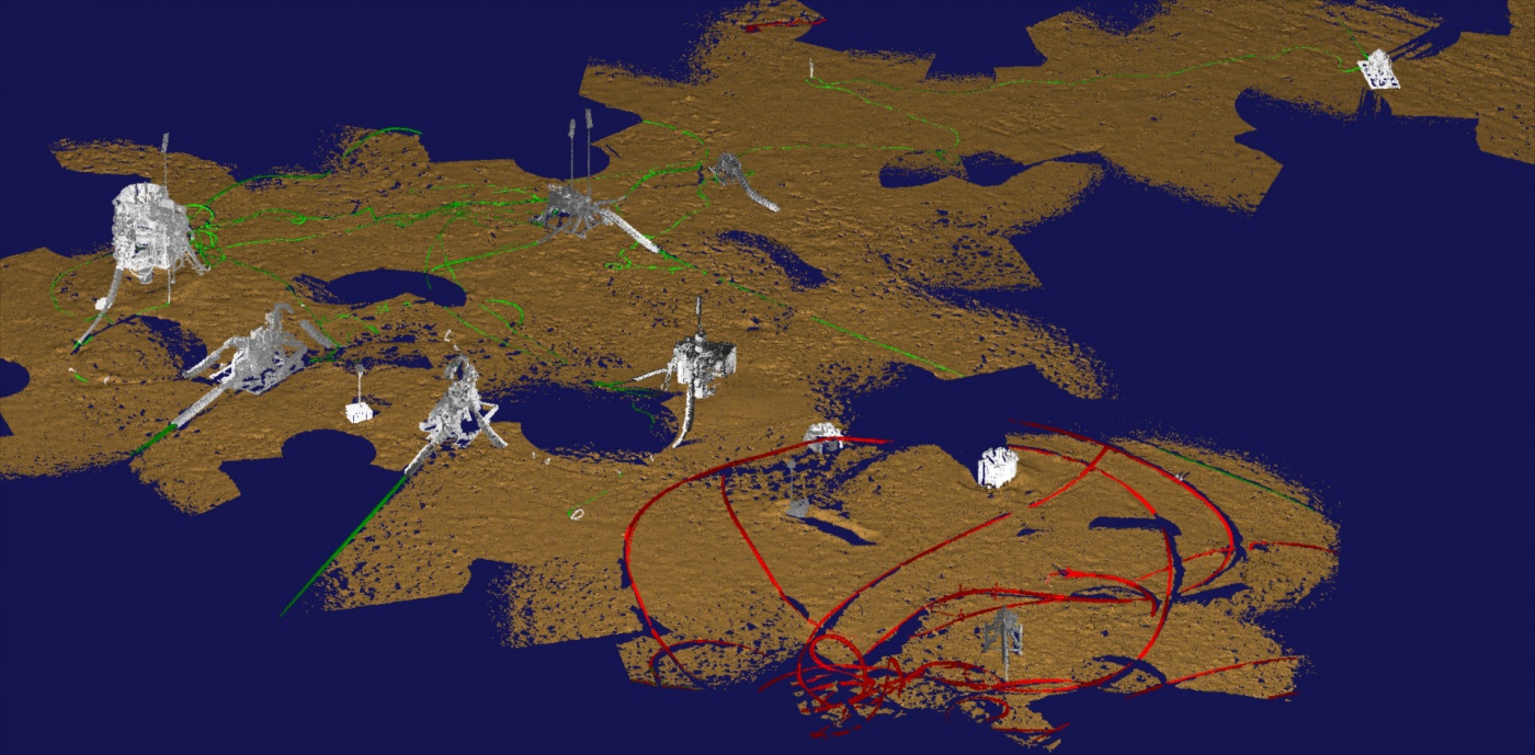
MBARI Collaborates with 3D at Depth on a New Detailed Design of the Next Generation Subsea Lidar Customized for Scientific Research.
READ MORE
3D at Depth Announces Strategic Collaboration with Schlumberger
Partnership News / 05/09/2017
Agreement Promotes Field-Proven Subsea LiDAR Solution Integration for Offshore Survey Applications
Boulder, CO, Sept. 05, 2017 (GLOBE NEWSWIRE) -- 3D at Depth, a global provider of advanced subsea LiDAR systems and solutions, announced today the establishment of a strategic collaboration agreement with OneSubsea, a Schlumberger company, to jointly advance 3D at Depth’s subsea LiDAR solutions for use in offshore survey data collection, visualization, and measurement applications.
READ MORE
3D at Depth Continues to Drive Growth For Subsea LiDAR Technology Worldwide
Partnership News / 28/04/2017
Applications for BBC One, National Park Service, and OceanGate's RMS Titanic Expedition Developed for Marine Archaeology and Virtual Reality Programs
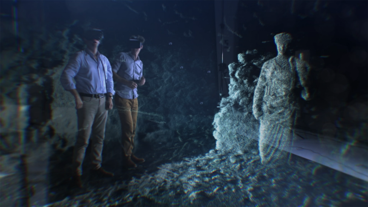
BOULDER, CO--(Marketwired - March 28, 2017) - 3D at Depth, a global provider of advanced subsea LiDAR systems and solutions, today announced their integrated subsea LiDAR technology delivered a new generation of enhanced 3D models and imagery for several recent customer projects. Each of the projects varied in scope, complexity, and depth with several of the locations requiring survey implementation near or around sensitive marine archaeological sites. Originally, 3D at Depth launched the first commercially available subsea LiDAR solution to serve the offshore oil and gas market. Today, the company has seen considerable interest from other industries where measurable, repeatable, millimetric data sets are a priority. Using the innovations developed for offshore metrologies and inspections, 3D at Depth was able to create advanced applications for deep-water marine archaeological site and structure mapping. For these particular projects, 3D at Depth's unique steerable LiDAR beam, combined with their powerful back-end software program, expanded the survey footprint and allowed for greater data penetration models.
READ MORE
3D at Depth and iXblue Develop Inertial Navigation System Aided LiDAR Data Collection Technology for Subsea Applications
Partnership News / 05/04/2017
Initial Deep water Trial Demonstrates Time Saving for High-Resolution Subsea Mapping and Metrologies
BOULDER, CO–(Marketwired – April 05, 2017) – 3D at Depth, a global provider of advanced subsea LiDAR systems and solutions, is pleased to announce, the success of a recent trial using Inertial Navigation System (INS) aided LiDAR data collection from a moving platform. The project was jointly sponsored by TechnipFMC and 3D at Depth, LLC with inertial navigation partner iXblue. Under the Joint Development Agreement (JDA), 3D at Depth and iXblue successfully integrated and collected motion compensated subsea LiDAR data of an oilfield in water depths greater than 2000 meter
READ MORE
Technip and 3D at Depth Form Alliance to Expand and Commercialize LiDAR Technology in Gulf of Mexico
Partnership News / 14/10/2015
Boulder, Co. — October 14, 2015 — 3D at Depth, a global technology provider of advanced subsea LiDAR systems and solutions, and Technip USA, Inc., an affiliate of Technip SA of France, announced today that they have signed a joint development agreement (JDA) to expand and commercialize the LiDAR technology for subsea metrology, field survey and IRM applications. Commonly referred to as laser scanning, LiDAR (Light Detection and Ranging) is a technology for collecting precise 3D models of subsea structures and seabed topography. It addresses the challenges of subsea data collection and imaging in deep waters for metrology survey programs and as-built field configurations.
READ MORE